Rising Tide of Innovation
One of Marin County’s most popular shorelines is drowning.
Over the coming decade, projected sea level rise will force up to 10 additional inches of water over the Mill Valley-Sausalito Pathway at Bothin Marsh Open Space Preserve, making the trail impassable at times and drowning the tidal wetland to the point it becomes inhospitable to the plants and animals living there.
This species-rich wetland at the mouth of Mill Valley is the result of environmental efforts to halt building on lands once primed for development. Now a common landing spot for migratory birds, the tidal wetland has become home to the endangered Ridgway’s Rail and other rare species of shorebirds that thrive on shorelines.
When clouds open or king tides surge, the shorebirds can be seen hiding in the rapidly declining high marsh in an attempt to wait out the deluge, exposing themselves to predators waiting in the skies above.
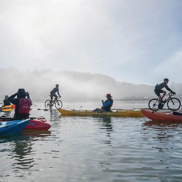
Watch: Take a kayak tour of Bothin Marsh.
With the acceleration of sea level rise, this situation becomes more dire for the plants and wildlife. It also greatly affects those who travel on the multi-use path through the marsh for recreation and transportation.
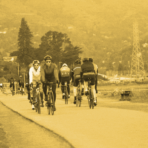
“The Mill Valley-Sausalito Multi-use Path is our most used park asset. So it can see over 2,000 visitors a day,” says Marin County Parks Project Manager Veronica Pearson. “It’s a popular transportation corridor for cyclists as well as being important for many locals who use it to recreate by walking their dogs or scenic wildlife watching, or birders who come from all over to look at the different migratory birds that pass through here.”
Retaining both the habitat and the recreational space will require a new generation of environmental stewardship.
Marin County Parks and the Parks Conservancy have leveraged the One Tam partnership — which also includes the National Park Service, Marin Municipal Water District and California State Parks—to engage the community in a dialogue around sea level rise to ensure common understanding and a shared vision for the future of this unique public shoreline.
The scope of the project will require an evolving collaboration between the community, public agencies, and partners. This method of empowering residents to participate in the process is known as community-based planning, and it’s the cornerstone of the adaptation plan at Bothin.
To connect with as many residents as possible, an Evolving Shorelines event series was developed. Outreach included guided kayak, bike, and walking tours, a family scavenger hunt, an historical ecology talk, and a community happy hour all focused on spreading awareness about challenges facing our collective open spaces. In all, 24 agencies and organizations joined their voices to affirm the shared value in preserving the marsh and path for future generations.
“We spent two years in pre-design, focused just on community understanding of the local impacts of sea level rise and gauging their support for protecting the ecosystem,” says Parks Conservancy project manager Rob LaPorte, who has engaged more than 600 individuals in his conversations about the developing project.
In recent months, those conversations were melded into conceptual design options for evolving the marsh and raising the pathway.
In 2020, the Parks Conservancy and Marin County Parks will present design concepts and strategies to the public for community input. Once implemented, strategies used in the preserve can serve stewards of other shorelines around the San Francisco Bay, offering real-world demonstration of tools used to evolve during sea level rise.
With hundreds of Marin residents actively engaged in the work, the Parks Conservancy and our partners are confident the community can chart the driest path forward at Bothin Marsh.